Apple has officially expanded its Maps service in Malaysia, adding support for public transit directions in major cities. Starting today, users can now plan journeys across Kuala Lumpur, Penang and Johor Bahru using a range of transport options including buses, light rail, monorail, ferries, and national rail. The feature also supports cross-border services and airport transfers, offering scheduled timings and estimated time of arrival (ETA) for a seamless experience.
Here’s a breakdown of the supported public transport services now integrated with Apple Maps:
Bus Services
- AEROBUS
- Airport Coach
- Bas Muafakat Johor
- Land Transit Authority Bus
- Causeway Link
- Causeway Link Airport Shuttle
- Go Genting Express Bus
- GOKL City Bus
- KR Travel & Tours
- MARALINER
- MRT Feeder Bus
- myBAS
- PJ City Bus
- rapidKL Bus
- rapidPenang
- Ridewell Travel
- Singapore-Johore Express
- SkyBus
- SMART Selangor
- Selangor Bus
- Star Shuttle
- Suasana Edaran Express
- Transtar Cross Border
- Wawasan Sutera
Bus Rapid Transit (BRT)
Ferries
- Alibaba Pulau Ketam Ferry
- Penang Ferry

Rail Services
- KLIA Ekspres
- KLIA Transit
- KTM Electric Train Service
- KTM Intercity
- KTM Komuter
Light Rail
- LRT Ampang Line
- LRT Kelana Jaya Line
- LRT Sri Petaling Line
- MRT Kajang Line
- MRT Putrajaya Line
Funicular Railway
- Penang Hill Funicular Railway
Gondola
Monorail

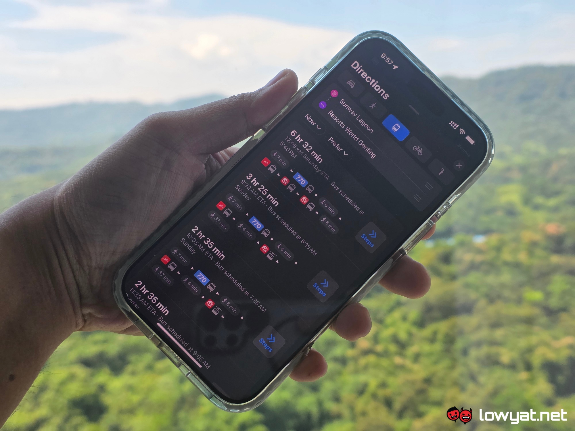
To access transit directions on Apple Maps, simply open the Maps app on your iPhone, iPad or Mac, and then enter your destination in the search bar and tap on the “Directions” button. After that, select the “Transit” tab (displayed as a train icon) to view public transport options. You’ll be able to choose routes based on departure time, estimated travel duration, and the number of transfers involved. Apple Maps will also display scheduled departure times and walking instructions to and from transit stops.

Transit navigation works seamlessly with Apple’s other features like calendar integration, Siri, and Apple Watch, helping users stay on track throughout their journey. You can also mark favourite routes, receive notifications for transfers, and follow real-time updates when available.
(Source: Apple Malaysia press release)
Follow us on Instagram, Facebook, Twitter or Telegram for more updates and breaking news.