So, you’re about to head down to a new restaurant in downtown KL via public transport. Most people, including yours truly, will whip out Google Maps for directions. Today, we get a new option for transit navigation, as Apple just announced that Apple Maps now supports transit directions here in Malaysia, at least in some major cities.
Transit directions available in KL, Penang, JB

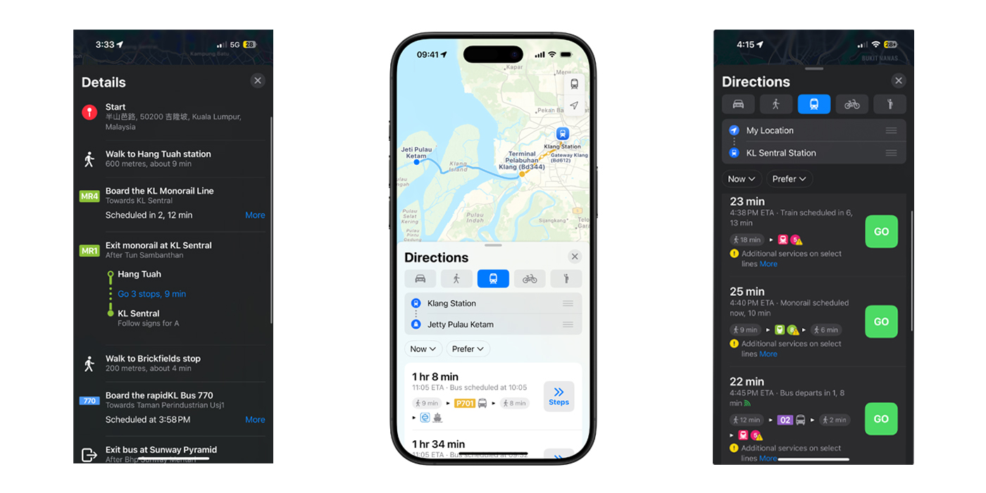
Currently, Apple Maps’ transit directions are available in Kuala Lumpur, Pulau Pinang, and Johor Bahru. Transportation modes such as buses, light rail, national rail, and ferries are supported.
Like Google Maps, Apple Maps will present you with multiple routes for you to choose from. Information such as estimated time of arrival and scheduled time for transit is also available to make your journey planning easier.
Here are the supported transit lines


Anyway, here’s a full list of transit lines supported by Apple Maps in Malaysia:
- Bus
- AEROBUS
- Airport Coach
- Bas Muafakat Johor
- Land Transit Authority Bus
- Causeway Link
- Causeway Link Airport Shuttle
- Go Genting Express Bus
- GOKL City Bus
- KR Travel & Tours
- MARALINER
- MRT Feeder Bus
- myBAS
- PJ City Bus
- RapidKL Bus
- RapidPenang
- Ridewell Travel
- Singapore-Johore Express
- SkyBus
- SMART Selangor
- Selangor Bus
- Star Shuttle
- Suasana Edaran Express
- Transtar Cross Border
- Wawasan Sutera
- Ferry
- Alibaba Pulau Ketam Ferry
- Penang Ferry
- Rail
- KLIA Ekspres
- KLIA Transit
- KTM Electric Train Service
- KTM Intercity
- KTM Komuter
- Light Rail
- LRT Ampang Line
- LRT Kelana Jaya Line
- LRT Sri Petaling Line
- MRT Kajang Line
- MRT Putrajaya Line
- Funicular
- Penang Hill Funicular Railway