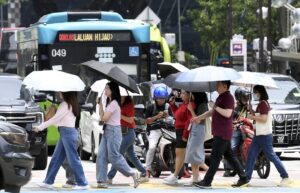
Oftentimes, when people think of a “smart city”, they imagine robots walking the streets, autonomous vehicles shuttling people to and fro, drones delivering packages, and other futuristic scenes.
In reality, the transition to smart cityhood starts off far more subtly than most would expect, as demonstrated by exhibitors from both the public and private sectors during the recent Smart City Expo Kuala Lumpur (SCEKL) 2025.
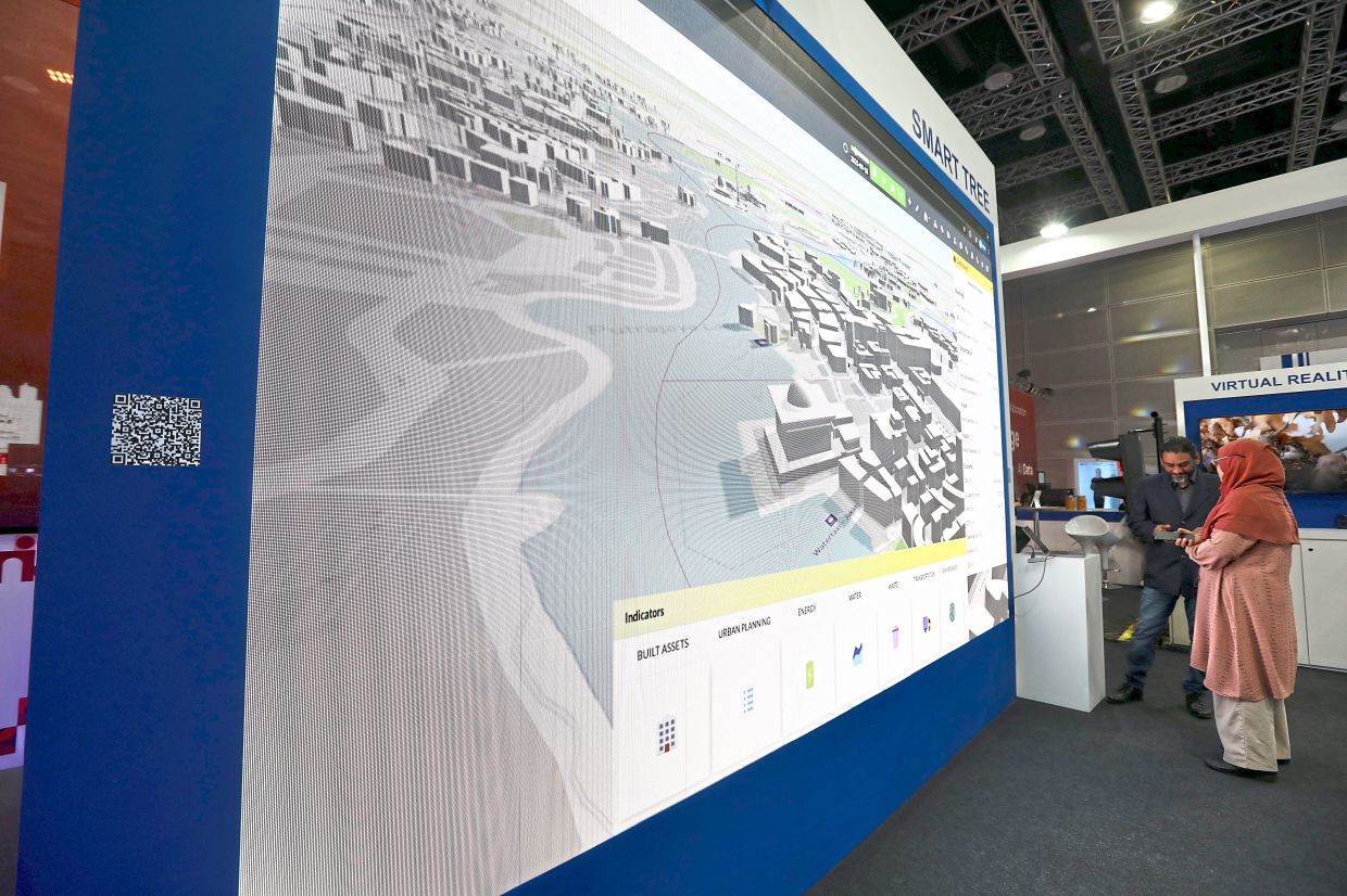
In Malaysia, budding smart cities such as Putrajaya and Kuala Lumpur, as well as the island of Penang, have thrown their hats in the ring for the creation of digital twins, which effectively create a virtual version of a city by combining both real-time and historical data.
This can then be used for deep dives into everything from traffic conditions and bus routes to housing development and the state of disaster prevention in a given area.
Smartening up a city
To begin with, what exactly is a digital twin, and how does it all work?
Based on a definition from the IBM website, a digital twin is essentially a virtual double of a real object or system.
For instance, it could be a 3D model of a particular building, complete with all the data on it at a user’s fingertips, ranging from temperature and room occupancy to the last time its infrastructure was serviced.
 A digital twin of Kuala Lumpur is currently in the works by DBKL. — LOW LAY PHON/The Star
Scaled up to an entire city, the insights from having a digital twin in place can be instrumental in guiding decision-making.
The implementation of a digital twin system has been one of Putrajaya Corporation’s latest initiatives, according to its ICT director Mohd Musabri Shaharom. He says that simulations from the system are being used in the city’s urban planning.
“Before management approves of any new developments, they are able to do a lot of simulations on how it might affect the surrounding area, and what kind of population it can support.
“For example, how many storeys can we build in this plot of land, how about the density, what is the impact on the neighbouring areas, the traffic and so on?
“From there, we can make better decisions – we can know the existing situations, and can do simulations based on the urban design being planned, with all the rules, what would be the impact if let’s say, we built a 30-storey building or put 1,000 people here? Those are the kind of things that we can do with a digital twin,” he says during an interview with LifestyleTech at SCEKL 2025.
The digital twin system in Putrajaya draws from a wide range of data points in the city, including bus routes and occupancy, traffic congestion, building density, and proximity to utilities and infrastructure.
Compiling all that data into a single platform lets city planners have a clear big-picture view and allows them to properly evaluate the impact of things like new developments through simulations and historical data for a particular area.
 Putrajaya is developing an AI avatar chatbot to assist city management with data from the urban observatory.
This will work alongside Melor, an AI avatar chatbot currently being developed by Putrajaya.
Once fully deployed, the avatar will connect to the Putrajaya Urban Observatory to support city management by providing insights on city benchmarking, urban indicators, and real-time dashboards.
Putrajaya has also completed a pilot project for autonomous buses, with plans for a wider rollout currently in the early stages, according to Mohd Musabri, with the long-term goal of having autonomous EV buses as a mode of transportation in the city.
Also at SCEKL 2025 was the Penang Island City Council’s (PICC) director of planning and development, Mohd Bashir Sulaiman, who says that the city is developing its own digital twin project dubbed the Virtual Island of Penang (VIP), which had its official launch on Oct 3.
The digital twin project aims to centralise geospatial data, urban development plans, and smart city metrics into a singular platform and, like the Putrajaya effort, allow for better decision making in everything from traffic management to evaluating if a new building is suited for a certain area.
“When we approve a development, we can check if it is zoning and policy compliant or not. Did the planner comply with our zoning and our building height requirements?
“The proposed building can even be added to the digital twin in 3D to see if it is suitable for the area or not. Building a modern building beside a heritage area would definitely be out of place,” he says.
 The VIP digital twin project will allow city planners to visualise the impact of new developments.
Mohd Bashir adds that the digital twin can even be used to identify hotspots for both crime and traffic accidents in collaboration with the Royal Malaysia Police (PDRM), which then allows the city to take the appropriate preventative measures.
He says that for the areas with higher incidents of traffic fatalities, the city has put in CCTVs to better monitor the situation.
“If the accidents or the traffic flow in an area is too much, then we must optimise the traffic flow, and plan better infrastructure.
“Some roads are stressed, which means that they need to be upgraded,” he says, adding that the system allows the city to visualise accident-prone areas, plan for improvement, and allocate a budget to improve the infrastructure accordingly.
Both cities have also implemented a tree inventory system that is integrated into the digital twin platform. (More on these arboriculture efforts can be found in the Oct 6 LifestyleTech cover story, ‘From canopies to code’, at tinyurl.com/dykbsvyp.)
As the inclusion of a tree inventory system implies, digital twinning is not limited to just building and roadworks management, but can also extend to a wide range of areas depending on a particular city’s needs.
For example, Penang’s implementation includes monitoring of aspects such as wind speeds, weather, and soil conditions as a precaution against landslides, which can then be used to take preventative measures and issue alerts to the public via the council’s Pearl superapp.
Mohd Musabri says that Putrajaya would be adding further simulations to the digital twin platform down the line. DBKL representatives at SCEKL 2025 said that the city is also planning for a similar digital twin system.
This could even extend to the interior of buildings. One example was highlighted by Huawei at its booth during SCEKL through its partner, healthtech firm Nubomed, which showcased how hospitals could track the exact location of equipment and patients, and monitor the remaining amount of administered IV drips.
All about data
As vast amounts of data are needed to create a digital twin for an entire city – a massive undertaking on its own – Mohd Bashir says that Penang is using an array of sensors in gathering this information.
“We have 26 weather stations on the island that we installed ourselves so that we can tell the people what the weather is like today.
“And around four with the air quality index, so the locals know what the air quality is like. We have this landslide application, so that we know what type of landslide happened, what the historical data is, which we can use for predictions.
“We have flood sensors that can help predict floods, and early warning systems too. This is where the world is going now,” he says, adding that other cities around the world, and some in Malaysia, have been moving in a similar direction.
Mohd Bashir further says that while CCTV cameras are nothing new, they are now being equipped with artificial intelligence (AI) to lighten the load on the humans monitoring the system.
For instance, rather than having a dedicated person comb through the various camera feeds on the lookout for things like illegal dumping and parking infractions, the AI would handle that task instead, only alerting a human if something is detected.
This is where both the Internet of Things (IoT) and network infrastructure step in, which is required to transmit the vast amount of data being gathered simultaneously across the city.
The same can be said for Putrajaya, which Mohd Musabri says is home to thousands of IoT-connected sensors that transmit data.
“All the sensors transmit in real time, so they use 5G, some of them use fibre optics, depending on the use case.
“For things like IoT sensors, we also use LoRa (Low-Power Wide-Area) networks, because they only use a small amount of data, maybe a kilobyte at a time. But for things like video, image, and audio streaming, we need fibre optics or 5G.
“We have weather, wind speed, temperature, everywhere in the city, with threshold management. So whenever, for example, if the speed of the wind reaches up to certain values, then it will trigger an alarm to the fire department,” he says.
 Smart traffic lights are equipped with cameras for roadway monitoring. — Photos: LOW LAY PHON/The Star
These sensors could even be directly integrated into infrastructure. One example would be the smart traffic and street light solutions exhibited by Henan Shengzhiyuan Intelligent Technology Co Ltd at SCEKL 2025.
According to a spokesperson with the company, its smart street lights project implemented in Zhengzhou, China, has seen a reduction in energy consumption in the city by 60%.
“Due to its adaptive brightness adjustment, the street lights can adjust by themselves, with the option to individually set the brightness levels for each one.
“This means that, let’s say between 2am and 5am when there’s hardly any traffic on the road, the system can adjust the brightness of the lamp, and this will produce huge energy savings.
“And then, if a car is going back somewhere late at night, it will trigger a sensor to switch on the light by itself,” the spokesperson says, adding that maintenance support was reduced from 24 hours down to just two hours.
This is due to the central monitoring system – which tracks all the smart city technologies – being able to detect faulty street lights whenever one goes dark.
Each LED light in the street lamps in Zhengzhou is estimated to have a 50,000-hour lifespan, which translates to about eight years of continuous use, assuming they are kept on for 12 hours a day, which the spokesperson says is unlikely due to the automatic dimming and shut-off system in place.
The company has also upgraded 2,000 intersections in Zhengzhou with AI-powered traffic lights designed to optimise traffic flow and combat traffic violations.
This has allowed for green wave coordination – meaning the timing of green traffic lights to allow for continuous traffic flow – in parts of the city where the smart traffic lights have been implemented, reducing traffic jams by 30%.
Henan Shengzhiyuan’s spokesperson claims that the technology has already been deployed in Lahore, Pakistan, resulting in a reduction in intersection accident rates by 28%, and the capture of an average of 30,000 traffic violations per month.
Similar efforts are also underway in Malaysia, with on-the-fly traffic light timing adjustments already deployed in parts of Putrajaya, Penang, and Kuala Lumpur.
At the end of the day, Mohd Bashir hopes that smart city tech will result in Malaysians seeing “sophisticated towns managed wisely, with the right decisions being made to give the best service to the people with no wastage of public funds”.
“This is the most important. When you want to make a decision on funding, you are basing it on facts and figures and incidents. It’s not just that you want to upgrade the road; there must be a reason why.
“So it will be well-spent money for the best interest of the people,” he says.
Mohd Bashir adds that this is all the more critical with the looming threat of climate change and global warming, saying, “It is very challenging, but we cannot run away. We need these sensors; we need IoT to help us. This is how we prepare ourselves to move forward.”